



Hex grids, now in GeoPandas 1.2
GeoPandas 1.2 adds make_grid: we covered the Philippines in 1,531 hexagons, 20 km across. Plus greedy coloring, basemaps, and GeoParquet 2.0 support.
Free QGIS courses · Open geospatial training
Free, hands-on QGIS workbooks, from your first map to atlases, reports, and forestry tenure maps. Learn at your own pace, or with us in an instructor-led training.
Less lock-in. More know-how.
BNHR helps fund QGIS's development as a sustaining member since 2020. Members' contributions fund QGIS's development and infrastructure. See QGIS's members (opens in a new tab) ↗
Every course is a free workbook with exercises and data. New to GIS? Start with Essentials.
A 16-hour introductory QGIS course: spatial data, coordinate reference systems, map projections, styling layers, making maps, and basic processing.
A 16-hour introductory QGIS course on attribute joins, georeferencing, digitizing, geocoding, selections, the field calculator, and QGIS expressions.
A 16-hour intermediate QGIS course on blending modes, geometry generators, data-defined overrides, rules, labels, and 3D, temporal, and web maps.
An 8-hour intermediate QGIS course on layout elements, templates, map themes, the QGIS Atlas, and QGIS Reports for creating and automating maps.
A 16-24 hour intermediate QGIS course for architects, planners, and urban practitioners: urban data, attributes, styling, map layouts, and the QGIS Atlas.
A 16-24 hour intermediate QGIS course on the maps, shapefiles, technical descriptions, and corner coordinates for SFLMA and forestry tenure applications.
A fact, a module, or an exercise you haven't seen yet. See all the facts.
Did you know? · Geospatial
On the Mercator projection Greenland looks bigger than South America, even though it is only one-eighth the size.
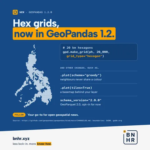
GeoPandas 1.2 adds make_grid: we covered the Philippines in 1,531 hexagons, 20 km across. Plus greedy coloring, basemaps, and GeoParquet 2.0 support.
No public trainings are scheduled right now. We also run instructor-led QGIS and open geospatial training for teams, online or in person, with certificates and support.