
Laying the foundation
Introduction
Section titled “Introduction”This module introduces the requirements of the Guide for the Standard Mapping (FMB Memorandum dated 15 February 2024) for forestry tenure applications such as SFLMA, and the coordinate reference systems you need to meet them. Everything in the later modules builds on these two topics.
What you should already know
Section titled “What you should already know”Familiarity with the QGIS interface as discussed in QGIS: Essentials - Introduction to QGIS, how to load different kinds of layers as discussed in QGIS: Essentials - Introduction to layers in QGIS, and the basics of map projections and coordinate reference systems as discussed in QGIS: Essentials - Introduction to geospatial concepts are preferred.
What the standard mapping guide requires
Section titled “What the standard mapping guide requires”The four required outputs
Section titled “The four required outputs”Every forestry tenure application is submitted with four digital outputs. Each one is covered by a module in this course.
| Output | Format | Covered in |
|---|---|---|
| Map of the subject area with the appropriate signatories of the concerned offices, company, or applicant | Map (prescribed layout) | The prescribed map layout |
| Shapefiles of the area’s corners (point) and boundary (polygon) with the prescribed attributes | Shapefile (.shp) | Preparing the area data |
| Technical description in the standard bearing-distance format, with the description of the tie point and tie line used | Spreadsheet (.xls) | Technical descriptions and corner coordinates |
| Computed coordinates of the corners | Comma-separated values (.csv) | Technical descriptions and corner coordinates |
One area, four views
Section titled “One area, four views”The four outputs are not four separate tasks. They are four views of the same area: the corners in the point shapefile are the corners in the technical description, the polygon is the area on the map, and the area on the map is the area in the attribute table.
Naming formats
Section titled “Naming formats”The guide prescribes the following file names:
| File | Format |
|---|---|
| Shapefiles (.shp) | <Region>_<Tenure Type>_<Point or Polygon>_<Applicant's Name> |
| Technical description and computed coordinates (.xls or .csv) | TD_<Region>_<Tenure Type>_<Applicant's Name> |
If the application involves multiple parcels:
- the technical descriptions and coordinates of each parcel are kept in separate sheets or tabs,
- each parcel has its own point shapefile, and
- all parcels share only one polygon shapefile.
For the sample application in this course, the files are:
IV-A_SFLMA_Point_Bagong Gubat Agroforestry Cooperative.shp (with .dbf, .shx, .prj, .cpg)IV-A_SFLMA_Polygon_Bagong Gubat Agroforestry Cooperative.shp (with .dbf, .shx, .prj, .cpg)TD_IV-A_SFLMA_Bagong Gubat Agroforestry Cooperative.xlsxTD_IV-A_SFLMA_Bagong Gubat Agroforestry Cooperative.csvShapefiles for submission, GeoPackage for your work
Section titled “Shapefiles for submission, GeoPackage for your work”The guide requires shapefiles, and the submitted files must be shapefiles. That does not make the shapefile a good format to work in. In this course, the shapefile limits show up in the tenure workflow itself:
| Shapefile limit | Where it shows up in this course |
|---|---|
| Field names are cut to 10 characters | The tie line’s fields TIE_DISTANCE and TIE_BEARING would become TIE_DISTAN and TIE_BEARIN, and REFERENCE_POINT would become REFERENCE_ |
| Text fields hold at most 254 characters | The guide’s Length: 255 becomes 254 (Module 2) |
| Field names ignore upper and lower case | A new field x collides with the prescribed X, so QGIS names it x_2 (Module 3) |
| One shapefile is several files (.shp, .shx, .dbf, .prj, .cpg) | Send or upload the files without the .prj, and the layer opens with no CRS |
| One layer per file | One application already needs two shapefiles, plus the technical description lines, tie point, reference layers, and project kept elsewhere |
A GeoPackage (.gpkg) is a single file that holds many layers, with long field names and no 254-character limit, and it can also store the QGIS project. In this course, the working layers (the technical description lines, the tie point, the reference layers, and the project) live in GeoPackages, and only the two submission layers are shapefiles, created with the prescribed fields from the start.
Read more in QGIS: Essentials - A quick note about shapefiles.
Coordinate reference systems for tenure mapping
Section titled “Coordinate reference systems for tenure mapping”The guide requires that the shapefiles of the corners and the boundary be projected using Luzon 1911 or PRS 1992 using the national grids.
Luzon 1911 and PRS 1992
Section titled “Luzon 1911 and PRS 1992”Luzon 1911 and the Philippine Reference System of 1992 (PRS 1992) are two geodetic datums used in the Philippines. Both use the Clarke 1866 ellipsoid, but they are not the same: the same point on the ground has different coordinates in each datum.
Older survey records and many reference monuments (e.g. BLLMs) carry Luzon 1911 coordinates, while newer records use PRS 1992. The datum you use is decided by the technical description and its tie point, not by preference.
The national grid (Philippine Transverse Mercator zones)
Section titled “The national grid (Philippine Transverse Mercator zones)”The national grid divides the country into five zones, each two degrees of longitude wide and centred on its own central meridian. Both datums use the same zones, so each zone has two CRSs in QGIS.
| Zone | Central meridian | Luzon 1911 | PRS 1992 |
|---|---|---|---|
| I | 117° E | EPSG:25391 | EPSG:3121 |
| II | 119° E | EPSG:25392 | EPSG:3122 |
| III | 121° E | EPSG:25393 | EPSG:3123 |
| IV | 123° E | EPSG:25394 | EPSG:3124 |
| V | 125° E | EPSG:25395 | EPSG:3125 |
All ten use a transverse Mercator projection with a scale factor of 0.99995 and a false easting of 500,000 m.
Don’t convert between Luzon 1911 and PRS 1992
Section titled “Don’t convert between Luzon 1911 and PRS 1992”QGIS can reproject between the two datums, but the result is not survey-grade, and it depends on which transformation QGIS uses. At the sample application’s corner 1 in General Nakar, the same coordinates read as Luzon 1911 instead of PRS 1992 land:
| Transformation QGIS uses | Rated accuracy | Shift at corner 1 |
|---|---|---|
| Luzon 1911 to WGS 84 (1), the default | 17 m | 7.7 m |
| Luzon 1911 to WGS 84 (2) | 44 m | 22.6 m |
| Ballpark geographic offset | none | 0 m |
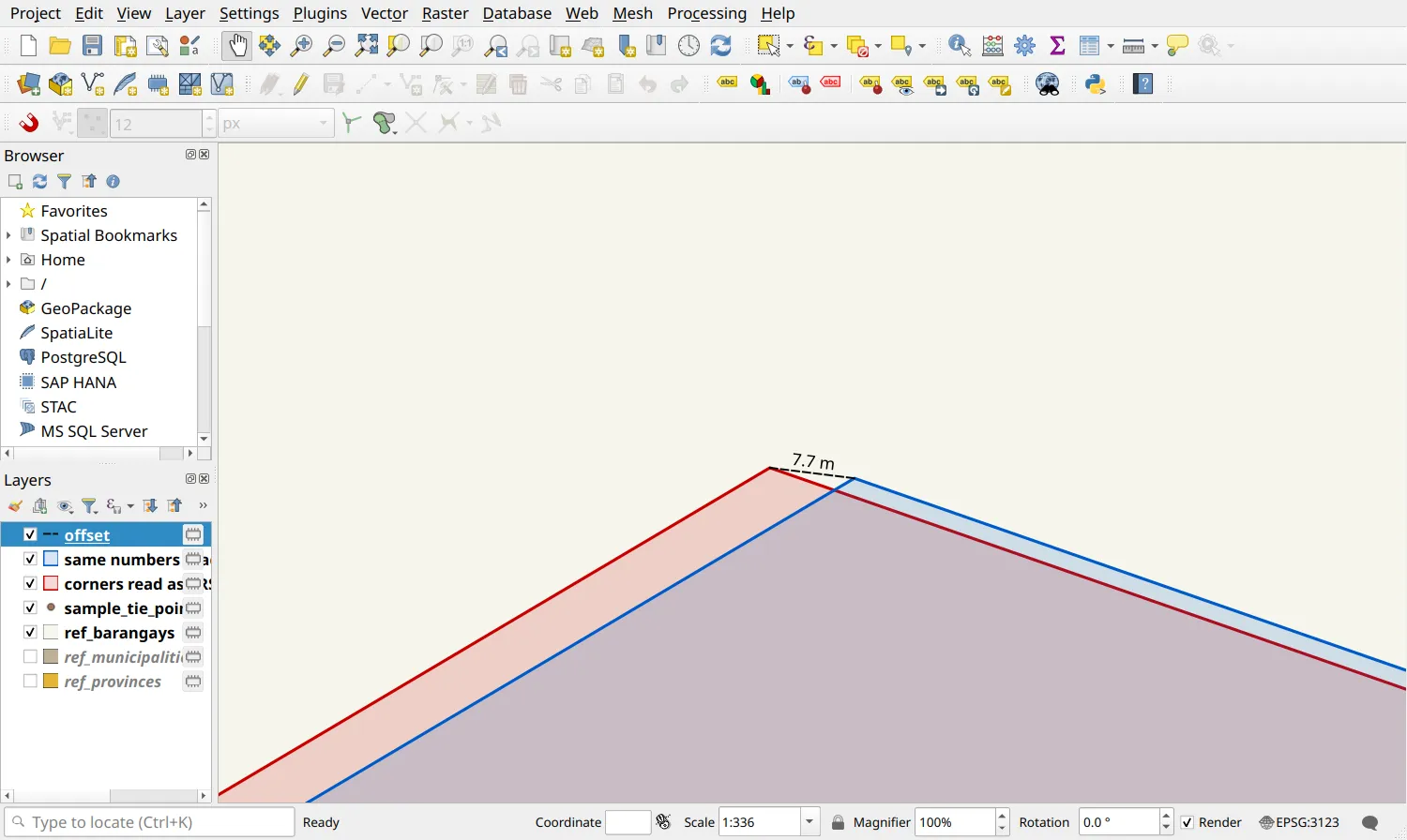
1.1. Setting up a forestry tenure project
Section titled “1.1. Setting up a forestry tenure project”What we want to achieve
Section titled “What we want to achieve”- A QGIS project set to the datum and zone of the sample application’s technical description, ready for the exercises in the next modules.
What we have
Section titled “What we have”- bnhr_qgis-sflma-mapping-001.gpkg inside the data subfolder of the BNHR_QGIS-for-SFLMA-Mapping folder.
- The sample technical description, which states its datum and zone.
- Read the sample technical description and identify its datum and zone. The sample application uses PRS 1992 Philippines Zone III.
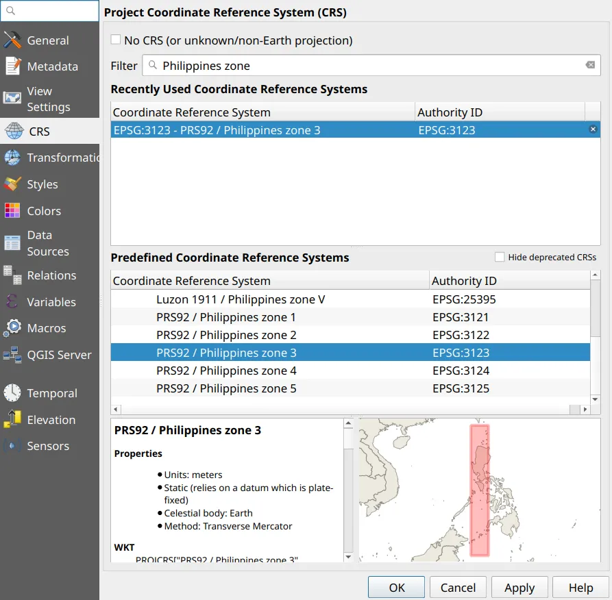
- Open Project ‣ Properties ‣ CRS. Type Philippines zone in the Filter box to list the national grid CRSs, then select PRS92 / Philippines zone 3 (EPSG:3123).
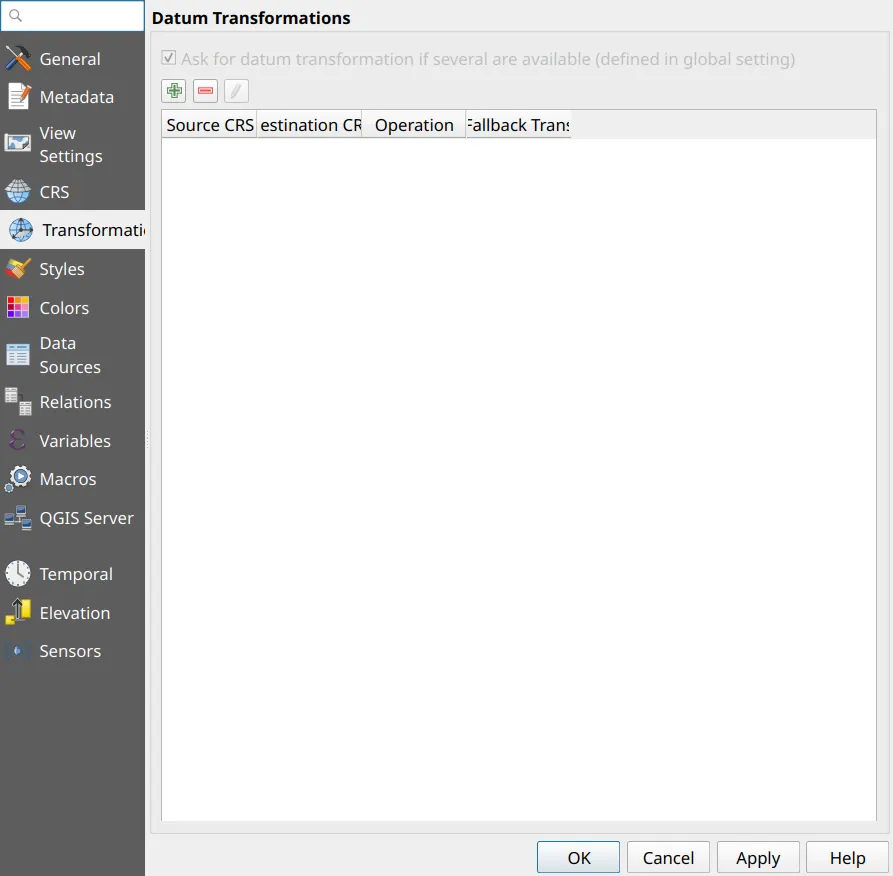
- Open Project ‣ Properties ‣ Transformations. When the list is empty, QGIS picks a transformation automatically whenever layers in other datums are loaded.
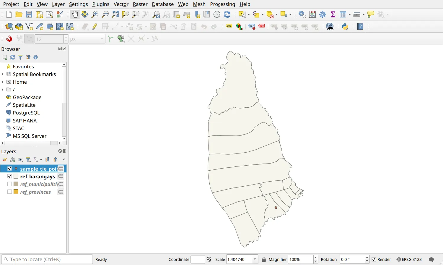
- Load ref_barangays, ref_municipalities, ref_provinces, and sample_tie_point from bnhr_qgis-sflma-mapping-001.gpkg and check the CRS of each one in Layer Properties ‣ Information. All of them are in EPSG:3123.
- Save the project (Project ‣ Save To ‣ GeoPackage) inside the GeoPackage so that the project and data travel together.
Beyond files: managing applications as data
Section titled “Beyond files: managing applications as data”Every application the office prepares or reviews adds a set of files: two shapefiles, a technical description, a coordinate file, and a map. Each check in Cross-validation and quality control, such as overlaps with existing tenures, is only as good as the reference data it is run against, and that reference grows with every approved application.
When the files of many applications are scattered across folders and upload links, it becomes hard to answer questions like which approved tenures does this application overlap? or which applications are in this barangay?, or to let several staff work on the same data at once. These are data management problems:
- a spatial database (PostGIS) that keeps every application and tenure in one place, checked with the same rules, and shared by several users;
- web services (GeoServer, OGC APIs) that let field offices view and use the same layers without copying files; and
- a catalogue (GeoNode) that makes the office’s maps and data searchable.
We teach these in Geospatial Data Management & Engineering with BNHR, from storing spatial data in PostGIS to sharing it with GeoServer and cataloguing it with GeoNode.
The bare minimum QGIS knowledge
Section titled “The bare minimum QGIS knowledge”Must-haves
Section titled “Must-haves”Map projections and Coordinate Reference Systems
Section titled “Map projections and Coordinate Reference Systems”- What’s the difference between geographic and projected CRS?
- How do you change the CRS of a project in QGIS?
- How do you change the CRS (reproject) of a layer in QGIS, and when should you not do it?
- How do you open and edit the attribute table?
- How do you use the Field Calculator?
- How do you create a new vector layer?
- How do you digitize with snapping and the advanced digitizing panel?
- How do you add a map, legend, scale bar, and north arrow to a layout?
- How do you save and open a layout template?
Certification and support
Join an upcoming training to take this as an instructor-led course, or contact us to arrange one for your team or organization.